Africa is home to several major river basins that play a crucial role in the continent's ecosystems, economies, and the lives of millions of people. These basins vary significantly in size, geographic location, and the challenges they face. Here's an overview of some of the most important drainage basins in Africa:
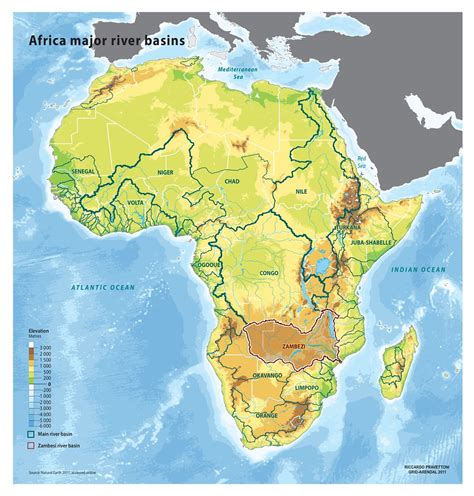
Map of major river basins in Africa.
Five Major River Basins
Africa has five major river basins:
- Congo
- Zambezi
- Orange
- Nile
- Niger
1. Congo River Basin
The Congo River Basin is the largest, covering an area of 3,730,470 km².
2. Zambezi River Basin
The Zambezi River Basin spans eight countries in Southern Africa. The Zambezi basin is an African drainage basin, whose main flow is the Zambezi River, being the fourth largest basin on the continent, in addition to being the most important basin in southern Africa. It covers approximately 1,390,000 km², crossing regions with high population density, sometimes in areas of low density, such as the Kavango-Zambezi Transfrontier Conservation Area.
Read also: Property Practitioners Regulatory Authority
The drainage area of the basin covers Angola, Botswana, Tanzania, Namibia, Zambia, Zimbabwe, Malawi and Mozambique, being the main supplier of fresh water, electricity and fish to the populations of these regions, mainly from the last five nations. Its main navigable course is through the Zambezi River, being the stretch of the mouth in the Indian Ocean (more precisely in the Mozambique Channel) until it surrounds the city of Tete, in the northwest of Mozambique.
3. Nile River Basin
The Nile is crucial for North-eastern Africa, sourced from the White Nile in Burundi and the Blue Nile in Ethiopia.
4. Niger River Basin
The Niger River stretches across West and Central Africa.
5. Orange-Senqu River Basin
The Orange-Senqu River Basin is significant in Southern Africa, crossing Lesotho, South Africa, Botswana, and Namibia.
Other Significant Basins
Besides the major five, other basins include the Komati, Ogooué, and Rift Valley basins.
Read also: Amazing Facts About Africa
Chad Basin
The Chad Basin is one of the largest in Africa and does not have an outlet to the ocean. Chad Basin, vast depression in Central Africa that constitutes the largest inland drainage area on the continent. Lake Chad, a large sheet of fresh water with a mean depth of between 3.5 and 4 feet (1 and 1.2 metres), lies at the centre of the basin but not in its lowest part.
The area is lined with clay and sand sediments and is rimmed by mountains, including the Tibesti Massif (north), Ennedi plateau region (northeast), Ouaddaï (east), and the Oubangui Plateau (south). The Chad Basin is a downwarped section of the Precambrian African Shield. Most of the older crystalline rocks are covered by more-recent deposits.
The most significant physiographic influence on the basin was a much larger ancient sea, sometimes called Mega-Chad, that formerly occupied it. At its maximum extent the sea was more than 600 feet (180 metres) deep, occupied an area of approximately 154,400 square miles (400,000 square km), and drained into the Atlantic Ocean through the Benue River system. It experienced four high stages between 41,000 and 2,300 years ago.
The history of the sea is documented in the stratigraphic record, which includes thick layers of diatomaceous earth, lacustrine sands, terraced shorelines, and the remains of modern fish and mollusks in now-arid tracts of the basin. The floor of the basin dips to the northeast of the modern lake, reaching its lowest point in the Djourab Depression, some 300 miles (480 km) away.
Exploring the Nile: unraveling the mystery of the world's longest river!
Read also: Discover Thula Thula
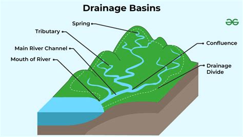
Map of major river basins in Africa.
Landscapes of West Africa
The 8 million square kilometers and 17 countries covered by this atlas encompass a wide range of landscapes from alluvial valleys in Senegal and Ghana, sandy plains and low plateaus across the Sahel, and rolling hills of Togo to rugged mountains with summits reaching over 1,500 m in Guinea and 1,800 m in Niger. Landscapes of West Africa: A Window on a Changing World is an atlas and unique dataset that uses time-series satellite image data and field-based photography to tell the story of wide-ranging land change across 17 countries.
Popular articles:
tags: #Africa
